Geoid and reference ellipsoids
The earth is an oblate spheroid with the minor axis 1/300th shorter than major axis but the earth also has an irregular undulating surface that varies by +/- 100m from the oblate spheroid. So the geoid is the approximation for shape of earth at “sea level” that takes into account gravitational and rotational inconsistencies.
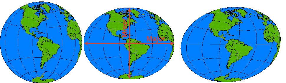
This irregular shape is approximated by “ellispoids” with a major and minor axis that fit particular parts of the globe better than others. In the US, the North American Datum of 1927 (NAD 27) uses the Clarke66 (that’s 1866) ellipsoid, named for British geodesist Alexander Ross Clarke. He measured the meridian arcs in Europe, Russia, India, S. Africa and Peru (with chains and surveying instruments). His radii are 6,378,206.4 m and 6,356,583.8 m for the equatorial and polar axes, respectively, with a fixed latitude and longitude at Meade’s Ranch, Kansas (39°13’26.686″ north latitude, 98° 32’30.506″ west longitude). In ArcGIS, open the Map Properties/coordinate system box, and choose the “geographic/spheroid based/Clarke 1866” coordinate system and click “New Coordiante System “to see its parameters.
View the “geoid,” modelof gravitational sea level for the whole earth.